Mignanego
Municipality in Liguria, Italy From Wikipedia, the free encyclopedia
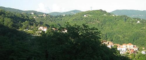
Mignanego is a municipality (Italian: comune) of the Metropolitan City of Genoa in the Italian region Liguria, located about 11 kilometres (7 mi) north of Genoa in the northeastern part of the Val Polcevera valley.
Mignanego | |
|---|---|
| Comune di Mignanego | |
 | |
 | |
| Coordinates: 44°31′N 8°55′E | |
| Country | Italy |
| Region | Liguria |
| Metropolitan city | Genoa (GE) |
| Founded | 1861 |
| Frazioni | Fumeri, Giovi, Montanesi, Paveto |
| Government | |
| • Mayor | Maria Grazia Grondona[1] |
| Area | |
• Total | 18.4 km2 (7.1 sq mi) |
| Elevation | 150 m (490 ft) |
| Population (31 December 2009)[3] | |
• Total | 3,727 |
| • Density | 200/km2 (520/sq mi) |
| Demonym | Mignaneghesi |
| Time zone | UTC+1 (CET) |
| • Summer (DST) | UTC+2 (CEST) |
| Postal code | 16018 |
| Dialing code | 010 |
| ISTAT code | 010035 |
| Website | Official website |
Geography
Mignanego borders the following municipalities: Busalla, Campomorone, Fraconalto, Genoa, Savignone, Serra Riccò and Voltaggio (this one in the Province of Alessandria, Piedmont).
It contains four hamlets (frazioni) — Fumeri, Giovi, Montanesi, and Paveto [4] — and eight other villages (località): Barriera, Costagiutta, Migliarina, Pile, Ponte dell'Acqua, Ponterosso, Vetrerie, and Vittoria. Vetrerie is the most populated village and the municipal seat; it is sometimes identified simply as Mignanego.
References
External links
Wikiwand - on
Seamless Wikipedia browsing. On steroids.


