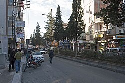
Nizip
District and municipality in Gaziantep, Turkey From Wikipedia, the free encyclopedia
Nizip (Medieval Greek: Nisibis or Nisibina; Ottoman Turkish: نزيب[2]) is a municipality and district of Gaziantep Province, Turkey.[3] Its area is 944 km2,[4] and its population is 148,386 (2022).[1]
Nizip | |
|---|---|
District and municipality | |
 | |
 Map showing Nizip District in Gaziantep Province | |
| Coordinates: 37°00′36″N 37°47′50″E / 37.01000; 37.79722][[Category:Pages using gadget WikiMiniAtlas]]"},"html":"Coordinates: </templatestyles>\"}' data-mw='{\"name\":\"templatestyles\",\"attrs\":{\"src\":\"Module:Coordinates/styles.css\"},\"body\":{\"extsrc\":\"\"}}'/>37°00′36″N 37°47′50″E / 37.01000°N 37.79722°E"}"> | |
| Country | Turkey |
| Province | Gaziantep |
| Government | |
| • Mayor | Mehmet Sarı (AKP) |
Area | 944 km2 (364 sq mi) |
| Population (2022)[1] | 148,386 |
| • Density | 160/km2 (410/sq mi) |
| Time zone | UTC+3 (TRT) |
| Postal code | 27700 |
| Area code | 0342 |
| Website | www |
It is located 45 km from the city of Gaziantep, 95 km from Şanlıurfa (Edessa), and 35 km from Karkamış.
Demographics
In early 20th century, the town housed 15,000 people and was mostly inhabited by Turks.[5]
Composition
There are 109 neighbourhoods in Nizip District:[6]
- Adaklı
- Akçakent
- Akkuyu
- Alahacı
- Altındağ
- Aşağıbayındır
- Aşağıçardak
- Atatürk
- Bağlıca
- Bahçeli
- Ballı
- Belkıs
- Boyluca
- Bozalioğlu
- Çakmaktepe
- Çanakçı
- Çatalca
- Cumhuriyet
- Dayıdağı
- Dazhüyük
- Dernek
- Doğrular
- Duraklı
- Dutlu
- Düzbayır
- Ekinci
- Erenköy
- Eskikonak
- Eyüp Sultan
- Fatih Sultan
- Fevkani
- Fevzipaşa
- Fırat
- Gaziler
- Gevence
- Gökçeli
- Güder
- Gülkaya
- Gümüşgün
- Günaltı
- Gürbaşak
- Güzelköy
- Hafızpaşa
- Hancağız
- Hazımoğlu
- İkizce
- İntepe
- İstasyon
- İstiklal
- Kale
- Kamışlı
- Karaburç
- Karşıyaka
- Kayalar
- Keklik
- Kesiktaş
- Kıbrıs
- Kıraçgülü
- Kıratlı
- Kızılcakent
- Kızılin
- Kocatepe
- Korucak
- Köseler
- Kumla
- Kurucahüyük
- Mağaracık
- Mehmetobası
- Menderes
- Mercanlı
- Mevlana
- Mihrap
- Mimarsinan
- Nahırtepe
- Namıkkemal
- Özyurt
- Pazarcami
- Saha
- Şahinbey
- Salkım
- Samandöken
- Samanlı
- Saray
- Sarıkoç
- Sekili
- Şıhlar
- Söğütlü
- Suboyu
- Sultan Abdulhamit
- Tahtani
- Tanır
- Tatlıcak
- Tosunlu
- Toydemir
- Tuluktaş
- Turlu
- Turnalı
- Uluyatır
- Yağcılar
- Yağmuralan
- Yarımtepe
- Yeniyapan
- Yeniyazı
- Yeşilevler
- Yolçatı
- Yukarıbayındır
- Yukarıçardak
- Yunus Emre
- Zeytinlik
Notable people
- Cahit Tanyol (1914–2020), Turkish sociologist
- Mehmet Ali Yaprak (1949–2004), Turkish businessman and drug trafficker
- Mustafa Cengiz (1949–2021), businessman who served as the president of sports club Galatasaray S.K.
- Mehmet Görmez (born 1959), former President of the Presidency of Religious Affairs and as such legally the highest level Islamic scholar in Turkey and the Turkish Republic of Northern Cyprus.
- Zihni Çakır (born 1969), journalist and author
- Ali Şahin (born 1970), Turkish politician who has been Deputy Minister of European Union Affairs since January 2016.
- Abdulhamit Gül (born 1977), Turkish politician
Gallery
- Nizip Town
- Nizip Town view
- Nizip Mosque
- Nizip Arched road
- Nizip Architectural sight
- Nizip Architectural detail
- Nizip Fevkanı church
- Nizip Fevkanı church
- Nizip Fevkanı church
See also
References
Wikiwand - on
Seamless Wikipedia browsing. On steroids.


