[go: up one dir, main page]
More Web Proxy on the site http://driver.im/

Kanjut Sar

Mountain in Pakistan From Wikipedia, the free encyclopedia

Kanjut Sarmap

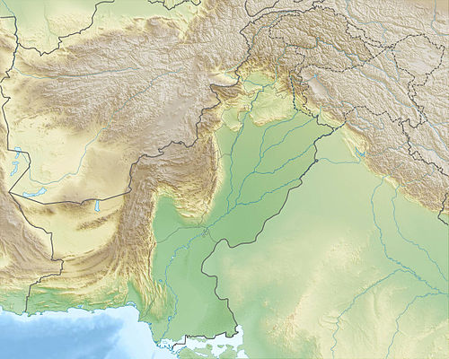
Kanjut Sar (Urdu: کنجت سر), or Kunjudh Sar as pronounced in Wakhi, is a mountain located between Shimshal Valley, and Hisper valley part of the Karakoram mountain range. The name Kunjudh Sar in Wakhi means "that which overlooks Kunjudh", or "above Kunjudh", while Khujudh is the Wakhi name for Central Hunza. It is the 28th-highest mountain in the world. According to many residents of Shimshal, Kanjut Sar is the name of the adjacent peak Yukshin Gardan Sar, and vice versa. In Shimshal village, the original namings are widely accepted and used, as opposed to what is recognised internationally.

Quick Facts Kanjut Sar کنجت سر, Highest point ...
Kanjut Sar
کنجت سر
Thumb
Yukshin Gardan Sar (background left) and Kanjut Sar (background centre)
Highest point
Elevation7,760 m (25,460 ft)[1]
Ranked 28th
Prominence1,660 m (5,450 ft)[1]
ListingUltra
Coordinates36°12′18″N 75°25′06″E / 36.20500; 75.41833][[Category:Pages using gadget WikiMiniAtlas]]"},"html":"Coordinates: </templatestyles>\"}' data-mw='{\"name\":\"templatestyles\",\"attrs\":{\"src\":\"Module:Coordinates/styles.css\"},\"body\":{\"extsrc\":\"\"}}'/>36°12′18″N 75°25′06″E / 36.20500°N 75.41833°E / 36.20500; 75.41833"}">[1]
Geography
Thumb
Kanjut Sar
کنجت سر
Location in Gilgit-Baltistan
Thumb
Kanjut Sar
کنجت سر
Kanjut Sar
کنجت سر (Gilgit Baltistan)
Thumb
30km
19miles
Pakistan
India
48
The major peaks in Karakoram are rank identified by height.

Legend:
1:K2,  2:Gasherbrum I, K5,  3:Broad Peak,  4:Gasherbrum II, K4,  5:Gasherbrum III, K3a,  6:Gasherbrum IV, K3,  7:Distaghil Sar,  8:Kunyang Chhish,  9:Masherbrum, K1,  10:Batura Sar, Batura I,  11:Rakaposhi,  12:Batura II,  13:Kanjut Sar,  14:Saltoro Kangri, K10,  15:Batura III,  16: Saser Kangri I, K22,  17:Chogolisa,  18:Shispare,  19:Trivor Sar,  20:Skyang Kangri,  21:Mamostong Kangri, K35,  22:Saser Kangri II,  23:Saser Kangri III,  24:Pumari Chhish,  25:Passu Sar,  26:Yukshin Gardan Sar,  27:Teram Kangri I,  28:Malubiting,  29:K12,  30:Sia Kangri,  31:Momhil Sar,  32:Skil Brum,  33:Haramosh Peak,  34:Ghent Kangri,  35:Ultar Sar,  36:Rimo massif,  37:Sherpi Kangri,  38:Yazghil Dome South,  39:Baltoro Kangri,  40:Crown Peak,  41:Baintha Brakk,  42:Yutmaru Sar,  43:K6,  44:Muztagh Tower,  45:Diran,  46:Apsarasas Kangri I,  47:Rimo III,  48:Gasherbrum V

 
Location in Gilgit-Baltistan
LocationGilgit-Baltistan, Pakistan
Parent rangeHispar Muztagh, Karakoram
Climbing
First ascent1959 by Camillo Pellissier
Easiest routesnow/ice climb
Close
Quick Facts Simplified Chinese, Transcriptions ...
Kanjut Sar
Simplified Chinese坎巨提峰
Transcriptions
Close

Kanjut Sar consists of two peaks:

  • Kanjut Sar I at 7,760 metres (25,459 ft).
  • Kanjut Sar II, to the southeast of I, at 6,831 m (22,411 ft).

Kanjut Sar I was first climbed in 1959 by Camillo Pellissier, member of an Italian expedition directed by Guido Monzino. Between 4 and 6 August 1981, seven Japanese climbers of the same expedition climbed to the top.[2] In 2010, a Russian–American expedition attempted to climb on the Eastern Ridge of Kanjut Sar and reached 7450 m, but turned back in bad weather.[citation needed]

The first ascent of Kanjut Sar II was achieved by a Swiss team in 1985.[3] Expedition leader Toni Spirig, Ueli Stahel and Richie Ott finally carried it out in alpine style after several attempts . The climbers reached the summit on July 10.[4] The ascent route led over the north-west side.

On July 29, 1990, a Dutch expedition made the second ascent of Kanjut Sar II in alpine style via the south face.[5] Expedition members were Peter Kok, Frank Schmidt, Franck van den Barselaer, Hendrik Freie and Pieter de Kam.

See also

References

Loading related searches...

Wikiwand - on

Seamless Wikipedia browsing. On steroids.